
.
THE TROUBLE WITH WATER! THE DEVELOPMENT OF THE WATER SUPPLIES FOR LAUNCESTON TOWN by Jim Edwards.
Natural springs in many places supplied animal and man in the Launceston area for many thousands of years.
Springs (called lacus) on the hills above St. Stephens trickled down to join the Kensey river from the northern side and more springs begat rivulets from Dunheved Hill which flowed down from the south side of the valley. When man set up residence he did so because there were shelter, fuel and fresh, clean water in the vicinity and this is probably one reason the monks chose this site for their monastery and the collegiate church at St. Stephens around AD 930. A Royal Mint, also sited nearby, shows the great value man set upon the site.
A spring on Gallows Hill would have supplied a quantity of good water for the inhabitants of the monastery and local people and further supplies were obtainable from springs in the hillsides and the run-off waters, as and when required.
The well at ‘Gallows Hill’ was recorded as far back as 1232 AD. in a cartulary of the Priory regarding land grants when the stream emanating from the well was noted as a boundary:- “Grant and quitclaim by Jordan de Ridcarn to the priory in pure and perpetual alms of one small parcel of land which Robert Fot held of Jordan for 2d yearly and another small piece of land which Richard Prutell held of Jordan yearly for a halfpenny in the manor of Launceston; i.e., all the land he had above the way which went from the stream called ‘Stapheines laca’ to the gate of the court of the priory and from the way up as far as the well of St. Stephen”. Many such grants quoted watercourses as boundaries all down the years.
Springs of the northern side of Dunheved Hill ran from the direction of (present-day) Race Hill, Windmill Hill, and on the southern side near Dunheved Green. Several springs around Dunheved Green still form a small stream running down the valley by Woburn to join Harper’s Lake, which runs down from the cemetery, through Trecarne. Man tapped these natural supplies when he built a settlement near Woburn/Dunheved Green, and also at Chapple across the valley, long before William decided to cross the English Channel.
When the Normans entered the area, around 1068, and decided where to build their castle, one of the prime considerations would have been the reliable supply of fresh, clean water for their kitchen and animals, and wells were dug inside the castle walls, possibly even before other works commenced.
As the town and market grew up around the castle water would have been more necessary to supply the growing population and it would be natural to divert, impound, and improve the available springs for human use. It may be taken for granted that reservoirs would also be built wherever possible, under or over ground.
A number of wells were dug within the town walls, some have been filled in or capped, but local inhabitants can still point out where some wells and pumps stood in far off days, behind and sometimes within dwellings and shops. Other than a very few mentions in church records, little is known of these early years of water supplies, either of location or of quantities available, but, in the early C.15. written records were kept, somewhat sketchily, but still available to re-searchers of today.
From some of the papers in the County Records archives: “ 1405: 7 ½d. paid for pipes.
“Henry vi. – 1451: cleansing the horse pool and digging pits.
1460: cleansing the horse poole 9d.
Necessary Expenses: 38-39 Henry vi. For cleaning the west well and for ‘le lake’.
1469-70. Clean horse pool and West well. In 1451 ‘wages for making of pits at Northgate 2d. Wages to William Henneworde for making pits at Southgate 3d. for cleansing ‘le horse pole’ and the west well 1s.4d.”
Plus many more small bills and payments (on equally small bits of paper.)
An Indenture, signed by, among others, Henry Trecarell, Alderman, and dated March 1st. 1512, shows much more work being carried out on the water supplies, although, again, not specifying locations. Part of the document, after naming the participants, reads :
“…. and Aldermen have covenanted and bargained with the said Nicholas Adam and the said Nicholas in likewise with the said mayor and aldermen, in manner and form as follows, upon making conduits of water, that is to say, that the said Nicholas shall find lead and solder and cast, lay and sand the pipes and cisterns of lead, & everything do that belongs to conduits concerning the lead, having of the mayor and aldermen aforesaid, for every hundredth of lead to the conduits belonging, 7s.: and the said Nicholas shall have meat and drink during the laying of the lead, to the town is cost or 6s.8d. And over this the mayor and aldermen shall pay, or cause to be paid, on to the said Nicholas at the sealing of this Indenture 8s.2d.(?) of English money and, at the laying of the lead, the half the money that remains after the rat(?), and, at the end of the work, the whole money; and this work to be finished within a quarter after the mayor and aldermen have made the work all ready for him to lay; and the said mayor and aldermen shall carry the lead, if it be brought within 12 miles of Launceston. …”.
This document is sealed with six seals, the first a fleur-de-lis, the second of Trecarrell, similar to his coat of arms sculptured on the Church of St. Mary Magdalene.
Further extracts: – “1590:’We present the stewards for not repairing the South well, the West well and ‘Syperis Will’. ‘For cleansing the west well and for le lake paid to Cotsale for redying the lake, and Kytting and cleaning the well. For redying of the pole and cleansing the Westwyll.”.
Butcher’s rents for 1531-2, listing 28 butchers and their stalls in Launceston ‘quadrangle’ includes: “John Columbpeers held the North standing in the middell of the Streate, and Stephyn Daw, a new standing bi the Conduite”.’
(The thoroughfare we now call High Street was formerly called ‘Conduit Street’.)
At some time during man’s occupancy of Launceston, at least five holding tanks were constructed, but dates are not known. Two of these tanks still retain water supplies, the one beneath the Square being some fifteen feet wide and 34 feet in length and containing about six feet in depth of water. Also at some unknown past times, tunnels were constructed beneath Bounsalls Lane and Race Hill, (formerly called ‘Whyte Lane’).
At the top of Race Hill, on the west side, is a blind arch, which, before the road was widened (1930’s ?) contained a large granite water tank (2ft x 4ft. app.) used as a horse drinking trough – this trough was fed by a spring, apparently through the wall via a pipe from a spring source in the hillside.
The steps on the lower side led to Mr Hicks’ house but were used as a short cut to Windmill Hill. (People became such a nuisance that Mr Hicks had the path stopped up.)
On the top side of the arch was a dairy.
The Post & News: 5th May 1923: “INTERESTING DISCOVERY AT RACE HILL.
The Corporation workmen were repairing the road at Race Hill, just below Mr Fry’s shop. The roller continuously going over one point in the road caused it to dip considerably. Soon after, when the water-cart was passing over the same piece of ground, the horse’s foot went through a slab of stone but was prevented from falling. Subsequently, after some digging, a pit about 15 to 20 feet deep was found with three subterranean passages; one leading down the hill; a second leading under the houses on the right-hand side of the road looking up the hill; and the last up the road. Our representative visiting the spot was informed that the passages conveyed the old town water supply, and the hole was, in all probability, made to make it more convenient to gain admittance and give attention to anything that was out of order or needing repairs. An old resident who had been living in that particular neighbourhood at Race Hill for about 45 years could not recall it’s being opened at all. The workmen have procured some new slabs of stone and laid them in position so that there will be no more danger in that vicinity, for some time, at least.”
(Mr Fry’s shop was The Glencoe Stores, owned by Mr Samuel Fry; he was well-known for his own brand of baking flour. Label in Fry’s Wallpaper Shop, next door up the hill.)
These tunnels were re-discovered by workmen laying cables for the General Post Office in 1948 when a large hole suddenly appeared beneath their vehicle at the junction of Bounsell’s Lane and Race Hill. They were recorded as ‘dry wells with connecting tunnels.’
The Borough Surveyor, Mr W.K. Pickup, his assistant Mr G.T. Rowlands, and Justice Alderman W.E. Miller, were accompanied by local photographer, Mr A. Bawden, on a tour of the tunnels. A report of their inspection published in the “Post Office Electrical Engineer’s Journal, of January 1949, reads as follows:
“During the execution of a recent contract for ductwork difficulties were encountered in the shape of old wells which necessitated strengthening and building-up works to complete the contract satisfactorily.
“At the junction of Race Hill and Bounsalls Lane, a dry well, some 30 feet deep, was unearthed, and upon further examination, it was discovered that a large tunnel led from it. The matter was reported to the Town Clerk and Borough Surveyor, who arranged for the tunnel to be explored. It was found that the tunnel, about five feet six inches high and two feet six inches wide, was well preserved, and extended for some 100 yards, where it joined into another dry well with further tunnels leading off.
“The antiquity and use of the underground passages are not known with any degree of certainty, but the opinion is that they are several hundred years old, and formed part of a water collecting system with the wells being used as storage tanks to ensure a constant supply to parts of the town”.
In a report in the Cornish & Devon Post, Mr Pickup states he has been told of a further tunnel on some private land further down Race Hill, while the well in the Castle is reported to have a tunnel leading from it and there is evidence of further tunnels in the Castle grounds.
References to water supplies during the C.17. and C.18. are scarce, although Leland, on a visit to Launceston circa. 1760, commented: “The town is served
by two conduits of derived water”. An old pump, now preserved in the Castle grounds, bears the inscription ‘1796. I.H.’
In 1817 a reservoir was built at Gallows Hill to supply piped water to the inhabitants of St. Stephens. This was paid for by Hugh, Earl of Northumberland. The Earl also gave money to the town for other improvements, one of which was a reservoir at Dunheved Green, built at a cost of £2,000 and two men’s lives; this was completed in 1826.
In 1825 a tap was affixed to the inside wall of the South Gate, the granite backing stone bearing the inscription at the top – ‘P.C.H. 1826’. This was understood to have been fed from ‘an adit in Race Hill.
A report in the ‘West Briton’ newspaper of August 1832: “A Board of Health has been appointed at Launceston, and immediately steps are to be taken to compel persons to remove all nuisances and thoroughly drain the streets, & c. by the formation of a large common sewer. No case of cholera has yet been reported in Launceston, but the daily intercourse with Plymouth (where the disease had a firm hold) by vans, waggons, & C. renders it imperative on the local authorities to adopt every precaution against the introduction of the disease.”
Another report in the same ‘paper dated September 1833: “A correspondent informs us that the streets of Launceston are so much out of repair and the funds of the corporation on whom the duty of repairing them devolves, are so low, the surgeons of the place began to keep a sharp lookout for broken bones. Should the intention of lighting the town with gas be carried into effect, it will tend to allay the apprehension of the friends of those who may have to go out of doors after nightfall, during the winter.”
Cholera entered Britain through the port of Sunderland in 1832, changing life in the British Isles irrevocably, especially the attitude to clean water supplies. The first death from Cholera was reported on October 26th. and by Christmas, the disease had reached Newcastle, where 41 people died. By this time an Official Board of Health had been set up in London, and other towns quickly followed suit. News of the epidemic outbreaks had reached Cornwall and stricter quarantine measures were imposed at ports, including Falmouth and Padstow, which did a lot of trade with Ireland where cholera was already prevalent.
Bodmin and other towns quickly took action ordering the removal of filth from the streets, the cleaning of sewage pits and drains and the inspection of homes.
By the middle of November, the Launceston Board of Health had inspected every house in the Borough, many inhabitants were ordered to whitewash their premises, and a dust cart was provided to remove ashes and refuse. A water cart was provided to wash down the streets.
In August 1832, the Treasury Council issued instructions upon the formation and duties of local Boards of Health, which had to include at least one M.D. This was under the guidance of the Central Board of Health, the forerunner of the Ministry of Health. The disease reached London in February 1833, spreading panic and causing some of the nobility to prepare to move out. On 28th. April, the local press reported a suspected case of cholera at Falmouth, but the death was officially attributed to ‘exhaustion’.
No such doubt existed in Plymouth in the following June – within five weeks 154 cases were reported with 56 deaths, many dying within a few hours of the first symptoms.
Exeter was struck about the same time, reporting 595 cases by July 19th. and 181 deaths. A few days after the first case in Exeter, it had reportedly reached Lostwithiel, and a woman died while travelling between Devonport and Port Isaac on July 28th. Many more cases were reported by August and the St. Austell board passed a resolution that proprietors of vans and barges should be requested ‘to be particularly careful as not to take passengers from places in which cholera prevails unless they are in perfect health’.
The cholera passed Launceston completely during the first outbreaks, and it was not until the second great wave of the disease struck, in 1848/9, that a death was reported in the town attributed to cholera, and that was not a local citizen but an unfortunate salesman of street furniture from Worcester, who died suddenly while staying overnight in the White Hart Inn.
In the meantime, the Launceston Board of Health had called in a Surveyor from Penzance, Mr Geo. T. Clark, as a Superintending Inspector, whose duty it was to carry out a survey of the Borough and make recommendations for improvements to water supplies, sewage disposal, drainage, and street paving.
Mr Clark’s first recommendation was that the borough boundaries be altered to allow a single scheme to supply water to the whole of the borough; this would be to build a reservoir above St. Stephens of three million gallons, and to enlarge the Dunheved Green tank to hold one million gallons, giving a four million gallons reserve of freshwater.
The St. Stephens supply would be Eight feet above the Dunheved tank, so feeding by gravity would mean an inexpensive option.
The Dunheved supply was 39 feet 2 inches above the door cill of the White Hart (the summit level of the town), and 46 feet above the base of St. Mary’s church. A total of 245 feet above the bed of the River Kensey at the bridge.
Another of Mr Clark’s recommendations was that the footpaths of the town should be paved with Three-inch cubes of granite. He said: ’large slabs of this material wear unevenly and dangerously smooth’.
At the time of the survey, typhus was widespread in Launceston and the report pointed out that the sewers, where they existed, were open and joined cesspits in the streets. There were very few lavatories in the town and uncontaminated water was almost unobtainable. Many cases of typhus were being reported from the areas between Ram Alley, Harvey’s Lane and the alleys and courts between Fore Street and Back Street.
“Some of the best houses of the town are to be found in High Street and Broad Street and excellent shops in Church Street and around the junction with High Street. Most of these buildings are without back premises, and they have no privies whatever. All refuse is thrown into the street sink and Back Lane. The stench is terrible and during rain, the muck runs about the streets”.
Mr Joseph Short complained of the slaughterhouse, attached to the dwelling of Mr John Sutton, in Fore Street, where from 20 to 30 bullocks, sheep and pigs were slaughtered weekly, and there being no water on the premises or nearby. He said: ‘I believe it never to have been washed’.
Piggeries, abundant in the town, leaked from the King’s Arms, with the privy, through the retaining wall, and affected all the premises in the street.
“Existing water supplies were from wells, springs, rainwater butts and town waterworks. There were five public pumps, a well in Broad Street, a spring at Race Hill fed from an adit, and a spring at Northgate.
“The reservoir at Dunheved Green fed five subsidiary tanks through a Two and a Half inch iron pipe, which had corroded to One inch in parts, and usually failed in August and September. The St. Stephens supply was of good water and never failed.
“There was a public privy in Castle Ditch and one in the hillside on the road east of the town and the town was lit by 36 gas lamps, alight from dark to 3 am. except at full moon and moonlit nights. Coal was 23s. per ton.”.
The cost of implementing most of Mr Clark’s recommendations was estimated at £2,500. for the water, and a further £2,000. for sewage. A further survey stated the costs at near £7,000.
The proposals were disregarded and meetings took place between the borough council and rate-payers when further proposals were made, recommended, and thrown out. Some of the meetings became very irate and in the end, a scheme to bring water from Trethorne was put forward and implemented in 1850, at a cost of nearly £9,000.; but this was little better than the Dunheved reserves which were now abandoned, as well as several other ancient sources. Existing conduits in the town were also made useless by ‘improvements’ damaging or cutting them off.
The Dunheved Green reservoir was filled in in 1869 to enable Dunheved Road to be completed, but, before this, the whole question of decent supplies was brought into the limelight with very indignant ratepayers calling a meeting in 1866 about the ever-decreasing supplies. The Trethorne scheme not coming up to expectations of yielding 14 gallons per day per head of population (of 4,000), in 1867, another consultant, Mr Appleton, C.E., was called in only to give very similar advice as had Mr Clark concerning the building of reservoirs. Again, expert advice was ignored, and further supplies were sought from an adit at Trebursye. This scheme, at a further cost of £1.200., yielded only two and a half gallons per day per head, being still inadequate.
In 1881 another ratepayer’s meeting resulted in Mr Appleton being recalled for consultation in 1884 when he was already working on a scheme to build a storage reservoir as proposed in 1849, and again in 1867. Again, expert advice was disregarded, and the next grand scheme to be proposed was to bring water from Kingbear, near North Hill, only for this to be rejected, too.
Under the leadership of Mayor John Kittow, the borough council began another debate concerning the supplies of water to the town, in the early 1890s. They drew up plans for a scheme to draw water from Carne Down, near Altarnun, pipe it to the town, build a service reservoir and pipe supplies all around.
A contract was made with Mr Joseph Fisher of Millbrook, to build a waterworks at the source, dig trenches and lay pipes with leaded joints all the way to Launceston, a distance of some nine miles ‘as the crow flies’, and to build a service reservoir at the top of Windmill where land had been purchased of Mr.Pethybridge for the purpose.
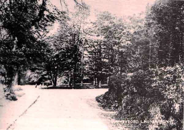
This scheme was completed and on the 31st. of October, 1895, after a lunch in the town hall, and led by the band of the Duke of Cornwall’s Light Infantry Volunteers, ‘half the town marched up Dunheved Road and up to the top of the hill’, to witness Mayoress Mrs Kittow, turn on the new supply for the town. The council had bought Four and a half acres of Upper Windmill Path Fields from Mr Pethybridge, and this land was dedicated to the people of the town as a ‘Pleasure Grounds’ at the same ceremony.
Other beneficiaries have supplied drinking facilities in the town. In 1894, as a memorial to a drowned son, Mr and Mrs Hender of Landrends, had a horse trough and fountain, complete with a dog drinking facility and a lamp above, erected in the square outside the new Guildhall.
(This may still be seen, in the grounds of the Windmill reservoir).
Mr S.P. Rattenbury of Stokeclimsland, donated a horse trough, to be erected at the entrance to the old pannier market on Race Hill, in 1908. (It is stated Mr Rattenbury donated Two troughs).
In July of 1899, some four years after its completion, a Launceston man, Mr Philip Connett of Kingdon’s Court, Fore Street, was found drowned in the reservoir. At the inquest into the death, a verdict of ‘Suicide while of unsound mind’ was recorded.
The reservoir on Windmill Hill, now lined with butyl to facilitate easier cleaning, was first an open one and the supplies from Carne Down were often contaminated by frogspawn, and then an infestation of worms from the source, causing another source to be sought. This was found at Bastreet, close to a former proposed source at Kingbear, North Hill. This supply was later altered and is now pumped from the stream at a lower level, to be fed to the town by gravity through recently renewed pipes.
When Charles Gillbard gave the town the public park, Coronation Park, in 1937, he allowed for the overspill water from the reservoir to supply the swimming and paddling pools of the town’s new acquisition.. _________________________
Additional figures regarding water supplies: The reservoir is 354 feet above the bed of the River Kensey at the St. Thomas bridge, about 20 feet below St. Stephens Hills.
Northumberland House is approx 232 ft. 11 ins. above the river. The North Gate 106 ft. 6 ins.
The distance between Dunheved Green and the proposed St. Stephens reservoir – 1 ½ miles.
The bed of the Kensey app. 230 ft above sea level.
Prince Albert died of typhoid in 1861, due to the lack of adequate sewage facilities, and the cavalier attitude of staff and residents to the dirt and filth and lack of hygiene in the most basic form, in the Palace of Windsor!.
The Registrar General’s returns for 1849 of the mortality rate by districts in Cornwall:
District. Population. Deaths from Asiatic Cholera
Stratton 9,432. 2
Launceston 16,727 3
St. Germans 16,120 236
Liskeard 26,475 132
Bodmin 20,800 2
St. Columb 16,167 4
St. Austell 31,408 135
Truro 43,148 81
Falmouth 21,700 73
Helston 32,538 6
Redruth 48,047 133
Penzance 50,144 22
Scilly 2,582
____________ _______________
CHOLERA: The disease CHOLERA is an acute, often fatal disease, due to infection with a small comma-shaped, motile organism. The vibrio cholera which multiplies in the lumen of the bowel but does not penetrate the body tissue or blood. It causes copious, watery diarrhoea, severe vomiting, rapid dehydration and muscular cramps due to lack of salt, the suppression of urine and shock proceeding – in severe cases – to coma and death. The vibrio can survive on damp clothing for several days and in dirty water. It may be spread orally, by infected water or food, or by flies.
Cholera was discovered in India in 1817, when it then advanced rapidly across the Middle East and into Europe by 1830, reaching Britain through Sunderland in the Autumn of 1831.
Visits: 157