
.
By Jim Edwards
The first recorded highway of our district I can trace came down from the direction of Exeter and into, or beside Okehampton before the year 700AD. From Okehampton it came to Sourton Down and on westwards behind Bridestowe; it then followed the ridgeway, named Galaford which means the Forked Way, where it splits into two pathways beside an ancient earthwork. Around here was the scene of a great battle in 823, between the Britons and the invading Saxons, in history as Gavulford, where the Britons were routed and the Saxons went on to Hengist’s Down to meet the Danes, then allied to the Britons.
As above, the pathways split, one going on towards Tavistock, one continuing roughly on the same line west to pass Lifton and Launceston on the north and follow the ridge towards Egloskerry, Halworthy and to Tintagel. Many other routes may be traced around this area, pre-historic, Saxon and Roman, and many of those routes were followed by the Normans and, in turn, by modern highways, though these tend to follow the valleys where possible.
Well documented paved roads were built in Britain by the Romans from the time they first arrived. Many of their main through roads were built of rammed earth covered by stone, also rammed tight then sealed with earth and covered with stone slabs, later with concrete slabs, and tramped down by marching feet and cartwheels. Two thousand years later many stretches can still be found almost intact though many miles have been covered with asphalt by modern contractors since 1900.
After the Romans withdrew from Britain the roads and buildings, the drains and sewerage, were allowed to fall into disrepair and became overgrown and lost. Very few paved roads have been found which relate to the times between 500 to 1,000 AD., although some cities were fairly well-paved, mostly by the traders and wealthy lords. It was not until after the Norman descendants of Rollo crossed the English Channel in 1066 that we find any records of road making as we know it, only of tracks being formed by feet and animals.
One of the first mentions of a specific local road comes from deeds of 1272: “ the Royal Cornish Road which comes from the Cross of Dunhevet and goes to the vill of Rosmaryt”. A signatory to this deed is Ivo de Landren and another, Richard de Kestel. Another similar deed gives the same description of road and signatories plus “given at Landren of Thursday . . ..
We know wheeled vehicles were used many years before the Romans arrived but very few records appear of use after they left Britain’s shores. Celia Fiennes in her travels of 1698 observes of Cornwall “the harvest is carried on backs of horses, called Cornish Caveleys, they are very small”. Other sources state that, at the end of the eighteenth century, ‘the bulk of ores and coal was carried by packhorse and mule. Most other goods too. A ‘pare’, or train of mules could be up to sixty to seventy animals, but usually, twenty-one, led by a lead mare, each carrying two 1.1/2 hundredweight leather or ‘poldavey’ [canvas] sacks. Earlier one three hundredweight sack was used, but they were ungainly, hung badly, and were too heavy for the packmen to handle. In the mid-C.18., Borlase noted as many as 500 to 1,000 animals at a time at work in Hayle. In the 1790s Portreath could receive as many as 1,000 loads a day.
Long before this time, we know many roads must have been paved, even if badly, because of the number of coaches and other wheeled vehicles travelling most of the country.
On the 12th of June, 1351, Edward, first duke of Cornwall, signed an order to his steward that he must obtain cart horses for war purposes: “John Spede of Shelford Six cart-horses with all their harness, and attached the said John and his servants to drive the horses. . . .”
In 1385 there is mention of material being drawn from ‘the Quarry of Tremayle’.
From Henderson’s ‘Cornish Roads & Bridges’ I quote the following: “The chief and most ancient road into Cornwall, known in 960 as ‘Old Street’, and in the Middle Ages as the ‘Highway from London to the Mount’, was designed to follow the backbone, or watershed of Cornwall. It is still, throughout the greater part of its course the main artery of the West, and being a ridgeway, encounters few streams.
It enters the county at Polson Bridge over the Tamer which from time immemorial has been the ‘Beginning of Cornwall’. The ancient town and fortress of Launceston guard the gate. The road proceeds across the barren moor to Bodmin and so by Goss Moor to Mitchell and Redruth, its course being marked by barrows and other remains which indicate its great antiquity.
The next road in date and importance is the South Coast route linking up the towns of Liskeard, Lostwithiel, Truro and Helston.
Although we may not say that these are Roman roads, it is highly probable that they were British tracks in use before the Roman occupation.
There is no record of any stone bridge in Cornwall 1068; Domesday mentioning the ‘Manor of Penponta’ (Bridge end), now Altarnon, the first-mentioned Cornish bridge.”
Polson Bridge existed long before 1280.
In Launceston around AD1400, at the same time as St Mary Magdalene church was being built, town council records show payments for the carrying of stone and timber ‘by the wagonload’ and by ‘two-horse carriages’. From Peter’s book of Launceston’s history, regarding Borough expenses -” On the back of a parchment, details of the ‘Expenses of the New House in the Highway near le Almeshouse. Among these are: for carriage of timber from the house of Simon Skymek to ‘le Yeldhall’, 8d., to Stephen Tynke for 800 feet of boards, for carriage of the same boards to Launceston; for carriage of four wagonloads of timber from the field of John Stevyn to the Guildhall; for two two-horse carriages with timber from Trecarelford; – – – – for three wagonloads of timber from Bodmam for the same house”.
We also know from the above that wheeled vehicles were in regular use from at least this time showing that roads, however primitive, were being built in the West. When James II travelled through the Westcountry it is well recorded he had great trouble with his carriage falling into deep ruts and pits in the roads on his journey showing that good surfaces were not a great priority to the powers that were at that time. On the other hand, when the Normans built the castle many tons of stone and earth had to be moved, some from many miles distant so some sort of roads had to be in place even at that time. We have dates when certain roads and bridges were travelled or repaired but surfaces are not detailed and we do not know how good they were.
From Peter’s History: “September 4th, 1400 . . . . ‘and the aforesaid Mayor and Commonalty should not have, nor claim to have, road or passage by Sextonhaye to the Church of St Thomas, near the Priory aforesaid.’ We think that this road ‘by Sextonhaye’ was the present Wooda Lane [1885], or rather footway running near and parallel with it.”
I believe the road mentioned above to have been a road between the river and the church leading to Town Mills, as some time after the priory was built at St Thomas a new road was cut to allow better access to the North Gate of the town, the original route up St Thomas Old Hill being much too steep for carts and waggons. This road started just below the present-day railway bridge on St Thomas Road (a glance at the doorsteps of the cottages and the Railway Inn opposite will show the original height of the road), turned west and joined (present-day) Tredidon Road at the bend near the right-hand side of the road, following that road for several yards and turning south into (present-day) Wooda Road.
It then went up the hill to the north gate, joining the old hill just outside. (Look at the junction beside the old National School. It is my own opinion that this road would have joined with Underlane which was the main road to Egloskerry in early times. Underlane is mentioned in early records as is also Landrends and many plots of land.)
The road at the North Gate was about 106 feet and six inches above the bed of the river at St Thomas Bridge, a steep climb in such a short distance. The road we now call Wooda Road was, in the 19th century, called ‘Bonyshaye’.
Borough records of 1467-8, under the heading ‘Necessary Expenses’ states “for carriage of timber, by ten wains, from Huntenford to Launceston at 8d each wagon”, and mention is also made to the ‘Bridge called Poulston Brygge and Newbrygges”. In 1467, Grants of Indulgence were offered to contributors of money for Polson Bridge, and in 1505 the same for New Bridge. And in 1573 a bill was presented for ‘my horses fec stones frome the Priory, the 6 May,, and timber from Thomas Peter’s ground” and in 1599 complaints were made that “the road is too narrow for carriages” but no reference to which road is made.
Peter states, from Borough records, that in 1652 “St Thomas Streete was severely out of repair’ and that the Corporation ‘determined to pave the street, giving the contract to Nicholas Pethebridge, spending 3s for beer at the time. On 3rd February, 1653-4, the mayor paid Pethebridge for paving of St Thomas Street £15 and for carriage of stone which paved the Street £3 3s 6d.”
On 18th October 1655, Henry Hawke was fined ‘for turning the water [of the conduit there] over the pavement in St Thomas Street, to the prejudice of the pavement’. It cost Hawke 3s 10d.
On 29th April 1656, Pethebridge ‘was presented for not repairing the street in St Thomas Street, as he ought to do’ and in 1659, supervisor for the highway George Walkey, ‘was presented for neglecting his duty in not giving orders to repair the highway’.
In 1759, the main road through Cornwall from Exeter ran through Lifton, Launceston and
Egloskerry to Camelford, Wadebridge, St Columb and to Truro. A report of 1763 stated that the road from Launceston to Horsebridge was ‘well paved, while the Launceston to Liskeard via Linkinhorne road was good right through’.
A new road was cut between Liskeard and Torpoint in 1770.
In 1798, a young man, with theories of road building, was sent to Falmouth as a victualling officer. Here he was able to test some of his theories by making a road on the turnpike from Truro Workhouse to Keggan Mill, Tresillian, where he proved that a smaller stone made for a better, longer-lasting surface. The ideas of this young man, Mr John Louden McAdam, were taken up only very slowly by the majority of roads authorities.
The first bridge to be wholly constructed of iron was at Ironbridge, Shropshire, in 1779.
“Mail Coach at Poulson Bridge: On Friday last, as the mail coach was passing over Poulson Bridge, which separates Cornwall from Devonshire, one of the wheels came in contact with an angle of the wall, and the coach overset. There were four outside passengers on the coach; three of whom were precipitated over the bridge; the fourth hung on by his hands on the top of the wall, until he was delivered by the guard. A Mr Williams of London, one of the passengers, had his right leg badly fractured, and one of his ribs broken; another, a Portuguese, received several wounds and contusions in different parts of his body; the third escaped with a slight wound to his knee. The coachman was seriously hurt and the guard slightly.” The Launceston Weekly News, 14 August 1812.
During 1823 the Eastern Road was improved by the cutting of Exeter Street This was done to avoid the steep climb of Angel Hill which had previously been the route when a road was cut, in the 1750s, from where Dockacre House stands, past the ‘Bridewell’ house of correction and Mr Cooke’s warehouse, then on down to Polson Bridge, this had been done to avoid Ridgegrove Hill.
The new Exeter Road was then added to by the cutting of Tavistock Road in 1834, which went round the hill to Page’s Cross, again to avoid the climb over Whitey Lane, present-day Race Hill
Around 1856 a ‘Road Traffic Accident’ is recorded in the local paper when it reports: ‘a horse and cart accident in Wooda Lane as the cart, loaded with bones and old iron, wound its way down Wooda Lane on its way to Mr Wyse’s mill.’
In 1883 a footpath was formed from the junction of Dunheved Road to St John’s.
By the early 19C, it was decided that a new route would have to be built to enable vehicles to access the upper parts of the town more easily and a route around the castle was surveyed. The route surveyed was part of the Duchy Estates, and the law of the time was that the Duke may spend Duchy income but not dispose of property or assets. As there was no Duke at that time, the estates being vested in the king, King William, on advice from his council, requested an Act of Parliament to give him permission to part with enough land for the good of the town. The Duchy valued the land at £227 16s 3d., of which £84 7s 6d., was due to the Duchy and £143 8s 9d., to the lessee.
The king granted Launceston £200, with the promise that another £100 would be made available the next year if it were required. The new road was built in 1834 and was named King William Street in the king’s honour, however, the new road was always called just that by the local people and this became the name by which it is generally known in the 21st century – New Road, alias St Thomas Road.
Mr William Burt, builder, was called upon to build a retaining wall beside the road to support the castle foundations, and this still stands as a tribute to his skill as a builder, just one of the many examples still on show in the County.
The North Gate was then taken down to allow wagons and coaches better access from Wooda Road to Northgate Street which, until the New Road was opened was the main route from the north into the town.
In 1838, hand-broken stone was priced from 10d to 1/8d but was usually 1/- per cartload. Labourers were paid from 1/6d to 2/- per day and masons paved roads at 7d per yard.
Mr Clark’s report of 1849 states that ‘a sewer took in Fore Street and Northgate Street, picking up various catch pits and opening into fields above St Thomas Street and of sewers, then newly constructed, in St Thomas Hill and Lower St Thomas Street. He also mentions the filth and sewage running from the many piggeries and the dwellings in Westgate Street, some through the town and some out of the West Gate and down the fields past the castle entrance. This continuous outflow of wet sludge may have helped the grass grow but it certainly would have made no improvement to the road’s foundations in the affected areas.
The Trebursey Mine purchased a steam traction engine in 1862 to move their ore to Boscastle for shipping. This machine, with its trailers, made the journey from Launceston three times weekly, the two trailers each carrying 10 tons of ore, grossing 34 tons, with the weight of the engine and tender making a gross train weight of some 56 tons this surely tested the road surfaces. Little wonder there were many complaints of poor roads, frightened animals and burned hedges.
Considering that the use of asphalt can be traced back to 2,500 BC., it took a long time for it to be applied to ordinary road surfaces. Tarmac was first used in Britain to seal the London Road in Nottingham in 1845, but once the pneumatic tyre came into general use in the 1920’s the demand shot up as these tyres, plus the higher speeds, caused great wear on the ordinary water-bound surfaces then in use.
In order to build Dunheved Road, which would bypass Windmill Hill as the route to Landlake, the reservoir, dug in 1826, was filled in in 1869 and despite dire warnings as to the dangers posed by granite slabs underfoot, huge slabs of this material were used to make the pavements from 1891 in the town.
Colonel Deakin, owner of Werrington estate, in March of 1876, offered to give land to lower the road from Yeolmbridge to St Stephen’s and said he would double his subscription if the Council would enlarge the scheme. Estimate for the first scheme to lower the hill was £360; but for £300 more, they could lower St Stephens Hill also. The St Stephens proposal was to go round the back of Horwell School and come out into the Dutson to St Stephens road.
Tenders for the new road from Yeolmbridge were requested for 3 furlongs and 3 chains length of road from contractors.
The Launceston Board of Health decided to build a route around St Stephens Hill in 1879.
This new route was begun at the corner of Horwell’s school grounds and went up to the present road for 130 yards, then through three fields, a garden, and another field, up to the junction with the St. Stephens to Dutson Road. The cost of construction was £800. Mr Edward Rendell of Plymouth, who built the Town Hall in 1886, contracted to build Zulu Road, now Roydon Road, and he also built the Drill Hall on the Noah’s Ark site behind the Guildhall.
A threshing contractor, Mr Richard Weeks, was fined for allowing his traction engine and threshing box to be on the road without a man with a red flag in front and without sufficient manpower tending the machinery, in 1883.
A road, Green Lane, was closed when a farmer threw down a hedge into the road to enlarge his field. A meeting of irate protesters was called in the Western Rooms to discuss the consequences of the farmer’s action, in December 1884. The Mayor, addressing the meeting, said the public had been robbed of the use of “one of our prettiest country lanes” and the authorities were taking no action to have it restored. Mr R Robbins put forward a resolution that some of the councillors should meet with the Highways Board to urge them into action to have the road restored. He added that the road was obstructed by gates, so denying free access to the public. He also said that, when he became aware of the farmer’s actions, he had himself approached the Board of Health regarding the situation. The Clerk to the Board replied that it was none of their business, but some members made up a committee to meet the farmer and put forward the objections put to them. Some arguments regarding the right of farmers and of the public ensued. Many were the arguments and objections bandied around between the public, the farmer and the local authorities, without any solutions being agreed.
Mr Charles Gurney said that should he not wish to till his garden that was no reason why someone else should take it from him, and if the road had been unused, or little-used beforehand, why no reason why a farmer should take it for his own use. There was much applause from those present at these remarks. On the point that another road could be used to reach the same areas, Mr C. H. Peter said that the same could be said of Windmill since Dunheved Road had been built, but that was no reason why Windmill road should be closed. He suggested the gates be taken off and thrown into the field, something they had a perfect right to do.
Mr T. B. Hender said part of the reason for the Board doing nothing was that they were afraid they may have to repair the lane.
Another argument put forward was that of precedent, if this road was allowed to close, which other roads may be closed later. The meeting closed after a Motion to put the matter very strongly to the Highway Board to reopen the lane.
In the East Cornwall Times of December 27th, 1884, was the following, written by ‘The Mounted Postboy’: “Mr E Marshall’s pointed but well-timed remarks at the public roadway meeting on Monday last shows the need of a standing committee or something of that sort to watch over the public interests. Of late there has been a most deplorable spirit of vandalism abroad, and it is time everybody and everything in the shape of public men and things were put on their right and legal footing.”
In 1886 the Lower Walk was improved by lengthening it “from Mr Beazy’s house to Mr Congdon’s timber yard”, and in 1892 a piece of land was given by the Bayley Trust to widen and improve Horse Lane. This was to go round the Town Walls instead of over the top and along The Walk. A house is now built on the old road on the town wall.
In March of 1886, complaints were made to the Borough Council that the cost of main roads in Launceston had increased since 1882 from £32 to £84 per mile. The new road from the Guildhall to the Station cost £330 per mile.
Also in 1886 the plans for new shops and offices, opposite M/s White & Dingley’s in Westgate Street, were approved and £20 in compensation was offered for putting back the frontage line.
Borough records show that in 1891, an application was received by them for a gaslight to be supplied at Ridgegrove Mill to light the road there, but the application ‘was allowed to stand over’.
It was soon after this time, around 1892-4 that Launceston saw its first steam roller compacting some of the streets at around 27s 6d per day, plus the driver’s wage.
Polson Bridge was constructed of stone during the 15C and a new one of iron was built in 1828. Newbridge, Gunnislake was built in 1320; Greystone Bridge built by John Page, MP. in 1439. It is 225 feet long, has five arches, has been strengthened by injected concrete and is now under Devonshire County Highways jurisdiction. The roadway, of 10ft width, has small foot traffic passing places built out over the piers.
Horsebridge was built in 1437, is 200 feet long over seven round arches with double rings of voussoirs, (the wedge-shaped stones of the arches), the road is 12 feet wide plus foot passing places. St Thomas Bridge built in the 18th century
St Leonards, a packhorse bridge, was built with money donated by the townspeople in 1580. St Leonard’s Bridge: Consultation by the Borough Council regarding repairs – 19 January 1878
Feb 2nd 1878: ‘We fin the Bridg at St Leonard’s to be in decaye and not repayred wch is dangerous to theyn that pas that waie.” – xxvis, Nov 24 Eliz. March 22nd, 1878.
Yeolmbridge, described by Pevsner as the oldest and ‘most ambitious’ Cornish bridge. Built in the fourteenth century it has two pointed arches of dressed stone with three chamfered ribs. After many crashes at, and on the bridge, the approaches have been widened and realigned on both sides and the bridge strengthened with injected concrete in the late 1900s.
When the A30 dual-carriageway was built between Lifton Down and Launceston an agreement was made between the highways departments of Devon and Cornwall that each river bridge on the county boundary should be owned by one authority only. Every other bridge now belongs to Cornwall for maintenance purposes; Polson Bridge to Devon, Dunheved Bridge to Cornwall, Greystone Bridge to Devon, etc., making it much easier for either authority to carry out necessary works individually.
In 1939, at a town council meeting, Councillor SJ Fitze suggested a site for overhead parking in Launceston. A double-decker parking ground, with air-raid shelter, was proposed; “It would relieve the present parking congestion in the town, incorporate a bus station – a service which the town council must face up to in the near future”. The suggested site? – the ‘Old Sheep Market’.
Early Transport in the South West of England.
1st. Coach: “The first hollow turning coach” was built by Walter Rippon for Queen Elizabeth Ist.
1st. Hackney carriage plied for hire in 1634.
1st. Stagecoach ran in 1640. In 1648 coaches ran on the Edinburgh – Glasgow road, using six horses it took 6 days for the return journey, a distance of 44 miles.
Goods in Cornwall were carried on pack animals until near the close of the eighteenth century.
1st. Dray with wheels was in Liskeard, built by Salmon Bowden of St. Clear.
The first wagon was built in Liskeard circa 1790, but, being built of large timbers – the axles were of wood covered with sheet iron – it was too heavy for general use and was moved very little.
The first cart recorded in Penzance was in 1760.
There were some private coaches in Cornwall from early 18C.
The first coach recorded in Cornwall was of August 1644 when King Charles Ist. rode down with twenty thousand troops to fight the Earl of Wessex.
The family Hawkins of St. Erth are said to be the first Cornish family with their own coach, circa.1700.
The coach was last used in 1780 and is now preserved in the County Museum.
Coaches in Cornwall were still rare in the 1760s.
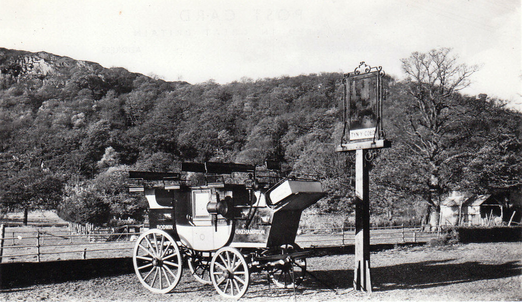
The Exeter to Falmouth coach used the Launceston – Camelford – Bodmin road around 1716{?]
1759 the turnpike from Launceston – Truro via Camelford – Wadebridge – St. Columb.
1769 Launceston – Bodmin – Indian Queens, over the moors.
Transport of the ages:
Barouche – derived from Latin biratus – two-wheeled carriage, but was often a four-wheeled carriage with a collapsible half-head, to carry four people and the driver.
Berlin – Four-wheeled covered carriage with hooded seat, possibly invented c1660 in Berlin.
Break – Brake – a carriage frame used in the breaking-in of young horses. Also a large wagonette.
Chaise – carriage of various shapes, low, four-wheeled, pulled by two small horses.
Chariot – four-wheeled carriage with back seats only.
Curricle – light two-wheeled carriage, usually for two horses abreast.
Diligence – foreign stage-coach.
Gig – light two-wheeled carriage drawn by one horse.
Landau – four-wheeled carriage, with top, independently drawn at front or back.
Litter – a couch enclosed with curtains, carried on the shoulders of two or four men or between two animals.
Phaeton – light, four-wheeled open carriage, usually drawn by a pair of horses. Earlier ones were two-wheeled.
Sociable – open carriage with facing side-seats, or a tricycle for two people side by side.
Times have changed little since then, with more traffic still to be injected onto the same roads, with the building of further factories and large housing estates being erected all around, both in town and village, we have to reach saturation point soon. It appears only then will action be taken to sort out the problems of future transport.
At this time of writing a new road is being built to access traffic from a new housing estate to be built in the Kensey Valley, with the possibility that this road would connect with the Newport Industrial Estate as a ‘Relief Road’. In fact, this traffic would only be using a road condemned by the highways authorities some seventy years ago as being not up to carrying traffic at that time.
J Edwards 5 November 2001.
Visits: 161